🔗 Union Transformation
In Geographic Information Systems (GIS), the union tool is used to combine multiple spatial features into a single dataset. It is typically applied when you want to merge overlapping or adjacent geometries and preserve their attributes.
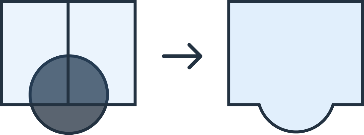
🧭 What is a Union?
- Combines geometries — overlapping or adjacent features are dissolved into one.
- Preserves attributes — attribute data from the input layers are retained.
- Creates coverage — ensures that the resulting dataset represents the full extent of all input features, with shared boundaries where overlaps exist.
This is particularly useful when analyzing relationships between multiple layers or creating comprehensive coverage datasets.
⚙️ Parameters
The union transformation takes no parameters.
{ "type": "union" }
📑 Example Usage
Example Config (SHP input → unioned DXF output)
{
  "input": { "format": "shp" },
  "transformations": [
    { "type": "union" }
  ],
  "output": { "format": "dxf", "epsg": 3857 }
}
Example API Call
curl -X POST https://api.geoflip.io/transform \
  -F 'config={
    "input":{"format":"shp"},
    "transformations":[{"type":"union"}],
    "output":{"format":"dxf","epsg":3857}
  }' \
  -F "input_file=@/path/to/input.zip;type=application/zip"
Response
{ "job_id": "abcd-ef01-2345-6789" }
Poll for status, then download from the returned output_url when the job reaches SUCCESS.
✅ Notes
- Union works with GeoJSON, SHP, and DXF inputs.
- Ensure
input.epsgis set for DXF files (since CRS is not stored in DXF). - Output can be requested in
geojson,shp, ordxf. - Union can be chained with other transformations (e.g., buffer → union).
➡️ Next Steps
- Learn about the Buffer Transformation
- See the API Overview for job flow